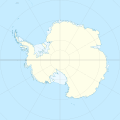
Payl:Antarctica location map.svg
Appearance

Size of this PNG preview of this SVG file: 600 x 600 ka mga piksel. Uban pang mga resoluyon: 240 x 240 ka mga piksel | 480 x 480 ka mga piksel | 768 x 768 ka mga piksel | 1,024 x 1,024 ka mga piksel | 2,048 x 2,048 ka mga piksel | 1,200 x 1,200 ka mga piksel.
Tibuok resolusyon (SVG nga payl, nominally 1,200 × 1,200 pixels, size sa payl: 233 KB)
Kaagi sa payl
I-klik ang petsa/oras aron makit-an ang hulagway sa payl niadtong panahona.
| Petsa/Takna | Thumbnail | Mga dimensyon | Tiggamit | Komento | |
|---|---|---|---|---|---|
| kasamtangan | 00:31, 9 Abril 2015 |  | 1,200 × 1,200 (233 KB) | Ravenpuff | Minor changes |
| 16:16, 3 Mayo 2011 |  | 1,200 × 1,200 (232 KB) | Alexrk2 | - | |
| 16:14, 3 Mayo 2011 |  | 1,200 × 1,200 (232 KB) | Alexrk2 | + Peter I. Insel | |
| 14:24, 21 Pebrero 2010 |  | 1,200 × 1,200 (217 KB) | Alexrk2 | == Summary == {{Information |Description= {{de|Positionskarte Antarktis, Mittabstandstreue Azimutalprojektion}} {{en|Location map Antarctica, Azimuthal equidistant projection}} * Longitude of central meridian: 0° * La |
Mga paggamit sa payl
More than 100 pages use this file. The following list shows the first 100 pages that use this file only. A full list is available.
- Allo
- Anna (pagklaro)
- Anne
- Balija (pagklaro)
- Bell Island
- Berg (pagklaro)
- Black Point
- Black Rock
- Blake Island
- Bray
- Buenos Aires (pagklaro)
- Burden
- Castle Rock
- Cat Island
- Channel Rock
- Clarence (pagklaro)
- Codrington
- Concepción
- Crooked Island
- Devils Point
- Dolores
- Egg Island
- Ema
- Entrance Point
- Flora
- Fontana
- Freeman Point
- Gale
- Galla
- Gourdon
- Green Point
- Guzmán
- Haller
- Hassel
- High Rock
- Hughes Point
- Hut Point
- Igla
- Jacobs Island
- Jama
- Jennings
- Johnson Island
- Karlik
- Lama (pagklaro)
- León
- Libertad
- Lira
- Lobo
- Loma
- Long Island
- Long Rock
- Low Rock
- Lynch Point
- Mari
- Martin
- Medio
- Moe
- Nares (pagklaro)
- North Beach
- North Point
- Ober-See
- Page
- Petras
- Pinnacle Rock
- Powell Point
- Red Hill
- Redonda
- Rocky Point
- Rose Rock
- Round Hill
- Saddle Hill
- Sail Rock
- San Fernando
- San Rafael
- Scott Shoal
- Scott Shoal (piliw)
- Seal Rock
- Signal
- Smith Island
- South Beach
- South Point
- Spanish Point
- Start Point
- Table Hill
- Table Mountain
- Three Sisters
- Toro
- Tri Brata
- Tula (pagklaro)
- Turtle Rock
- Twin Rocks
- Twins
- Victoria
- Villanueva
- Virginia
- Weissenstein
- West Point
- Williams Island
- Young Island
- Zajac (pagklaro)
View more links to this file.
Global nga paggamit sa payl
Kining ubang wiki naggamit ning maong payl:
- Paggamit sa af.wikipedia.org
- Paggamit sa ar.wikipedia.org
- Paggamit sa arz.wikipedia.org
- Paggamit sa ast.wikipedia.org
- Monte Hope (L'Antártida)
- Base Vostok
- Base Antártica Xuan Carlos I
- Base Concordia
- Monte Erebus
- Macizu Vinson
- Montes Tresantárticos
- Módulu:Mapa de llocalización/datos/Antártida
- Módulu:Mapa de llocalización/datos/Antártida/usu
- Picu del Príncipe d'Asturies
- Aeródromu Teniente Rodolfo Marsh Martin
- Aeródromu Wilkins
- Aeródromu de Molodiózhnaya
- Aeródromu de Punta Rothera
- Aeródromu de Troll
- Base Casey
- Base Davis
- Base Edgeworth David
- Base Fossil Bluff
- Base Halley
- Base Mario Zucchelli
- Base Mawson
- Base N
- Base Plateau
- Base SANAE IV
- Campamentu Glaciar Unión
- Estación Kohnen
- Islla Cacho
- Paggamit sa av.wikipedia.org
- Paggamit sa az.wikipedia.org
View more global usage of this file.


