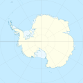
Fil:Antarctica relief location map.jpg
Utsjånad

Storleik på førehandsvising: 600 × 600 pikslar. Andre oppløysingar: 240 × 240 pikslar | 480 × 480 pikslar | 768 × 768 pikslar | 1 024 × 1 024 pikslar | 1 493 × 1 493 pikslar.
Opphavleg fil (1 493 × 1 493 pikslar, filstorleik: 459 KB, MIME-type: image/jpeg)

Følgjande er henta frå filomtalen åt denne fila på Wikimedia Commons:
Filhistorikk
Klikk på dato/klokkeslett for å sjå fila slik ho var på det tidspunktet.
| Dato/klokkeslett | Miniatyrbilete | Oppløysing | Brukar | Kommentar | |
|---|---|---|---|---|---|
| gjeldande | 26. juli 2017 kl. 08:52 |  | 1 493 × 1 493 (459 KB) | Amga | Reverted to version as of 16:03, 3 May 2011 (UTC). This is used in location maps, so don't rotate it! |
| 26. juli 2017 kl. 01:00 |  | 1 488 × 1 493 (458 KB) | SteinsplitterBot | Bot: Image rotated by 90° | |
| 3. mai 2011 kl. 17:03 |  | 1 493 × 1 493 (459 KB) | Alexrk2 | light blue hypso colors | |
| 21. februar 2010 kl. 22:24 |  | 1 500 × 1 500 (818 KB) | Alexrk2 | == Summary == {{Information |Description= {{de|Physische Positionskarte Antarktis, Mittabstandstreue Azimutalprojektion}} {{en|Physical Location map Antarctica, Azimuthal equidistant projection}} * Longitude of central |
Filbruk
Meir enn 100 sider bruker denne fila. Denne lista viser dei 100 første sidene. Ei fullstendig liste som bruker denne fila er tilgjengeleg.
- Aleksanderøya
- Altaret
- Amundsen Coast
- Amundsenhavet
- Anchorage Patch
- Archipel de Pointe Géologie
- Bakutis Coast
- Ballenyøyane
- Banzare Coast
- Bauna
- Biscoe Islands
- Black Coast
- Borchgrevink Coast
- Bowman Coast
- Bryan Coast
- Budd Coast
- Caird Coast
- Cairns Shoal
- Carstens Shoal
- Clarie Coast
- Colbeck Archipelago
- Cooperation-havet
- Curzon Islands
- Davishavet
- Deceptionøya
- Domashnyaya Bank
- Dufek Coast
- Eights Coast
- English Coast
- Entrance Shoal
- Fairway Patch
- Fimbulisen i Antarktis
- George V Coast
- Gould Coast
- Grytviken
- Harvey Shoals
- Highjump Archipelago
- Hillary Coast
- Hobbs Coast
- Holgate Shoal
- Katedralen
- Kelp Bank
- Kemp Coast
- King George Island
- Kirkby Shoal
- Knox Coast
- Kong Haakon VII Hav
- Kosmonauthavet
- Krabba
- Kronprins Olav Kyst
- Kronprinsesse Märtha Kyst
- Larsen Bank
- Lassiter Coast
- Lazarevhavet
- Luitpold Coast
- Maudheimvidda
- Mawson Coast
- Mawsonhavet
- Molholm Shoal
- Mount Stephenson
- Newman Shoal
- Orville Coast
- Owen Shoals
- Parry Patch
- Pennell Coast
- Peter I Øy
- Pitt Islands
- Prins Harald Kyst
- Prinsesse Astrid Kyst
- Prinsesse Ragnhild Kyst
- Pugh Shoal
- Riiser-Larsenhavet
- Robertsonøya
- Rocher des Drus
- Rymill Coast
- Sabrina Coast
- Saunders Coast
- Scott Coast
- Sea Leopard Patch
- Shackleton Coast
- Shirase Coast
- Siple Coast
- Somovhavet
- Stanley Patch
- Sør-Orknøyane
- Sør-Shetlandsøyane
- Vostoksjøen
- Wilhelm Archipelago
- Wilhelm II Land
- Wilkins Coast
- Windmill Islands
- Zumberge Coast
- Île Claude-Bernard
- Île Descartes
- Île Double
- Île Le Mauguen
- Île de Claquebue
- Île du Chameau
- Île du Derby
- Îles Buffon
Vis fleire lenkjer til denne fila.
Global filbruk
Desse andre wikiane nyttar fila:
- Bruk på af.wikipedia.org
- Bruk på ar.wikipedia.org
- Bruk på arz.wikipedia.org
- Bruk på ast.wikipedia.org
- Bruk på az.wikipedia.org
- Şablon:Yer xəritəsi Antarktida
- Antarktik yarımadası
- Şablon:Yer xəritəsi Antarktida (fiziki)
- Antarktik boğazı
- Jerlaş boğazı
- Bransfild boğazı
- Lemeir boğazı
- Vostok gölü
- Friksel gölü
- Mak-Medro boğazı
- Veddell dənizi
- Birlik dənizi
- Riser-Larsen dənizi
- Kosmonavtlar dənizi
- Mouson dənizi
- Dürvil dənizi
- Somov dənizi
- Kral VII Haakon dənizi
- Deyvis dənizi
- Lazarev dənizi
- Bellinshauzen dənizi
- Amundsen dənizi
- Ross dənizi
- Skotia dənizi
- Mouson yarımadası
- Hat Point yarımadası
- I Aleksandr Torpağı
- Berkner
- Ross adası
- Erebus vulkanı
- Saypl
- Terston
- Karney
- Ruzvelt adası (Antarktida)
- Sifre burnu
- Cənubi Şetland adaları
- Cənubi Orkney adaları
- Koroneyşen
Sjå meir global bruk av denne fila.


